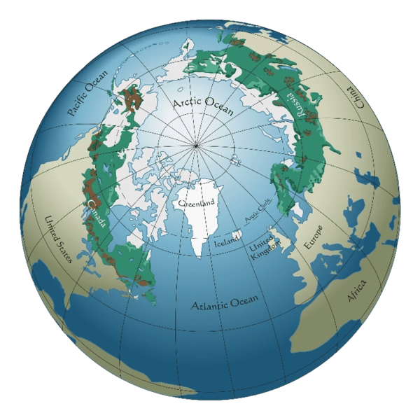
The boreal ecoregions of the Northern Hemisphere are a wonderland of breathtaking proportions, stretching across immense swathes of North America, Europe, and Asia.
Teeming with a plethora of amazing wildlife, including majestic bears, fierce wolves, and towering moose, these forests are also home to a mind-boggling array of plant, insect, bird, and fish species.
Given the vastness of these forests, it’s no surprise that the ecological characteristics of different areas can vary widely, from climate to topography and vegetation.
To better comprehend and manage the biodiversity of each region, ecologists have split the boreal forest into ecoregions.
This approach helps identify which areas require more protection and restoration efforts, allowing us to prioritize conservation actions where they are needed the most.
World Boreal Forests
What are Ecoregions?
For decades, the World Wildlife Fund (WWF) has been a trailblazer in the fight to preserve the planet’s most treasured ecosystems and wildlife. Their relentless work has helped safeguard our natural world for generations to come.

One of the most powerful weapons in the WWF‘s conservation arsenal is the concept of ecoregions.
With over 800 ecoregions identified across the globe, the WWF has an extensive toolkit to tackle the various ecological challenges that our planet faces.
From unique ecological characteristics to environmental threats and conservation challenges, each ecoregion presents a unique set of circumstances.
In this article, we’ll delve into the WWF’s split of boreal forests or taiga, with a focus on the 17 North American boreal ecoregions that make up this awe-inspiring ecosystem.
Table of Contents:
The Boreal Ecoregions – North America
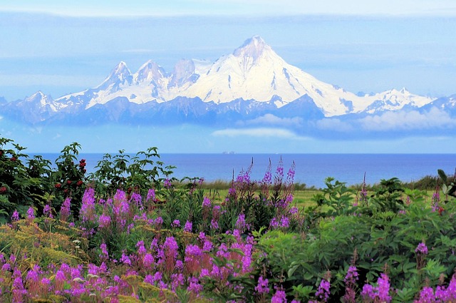
The North American Boreal Ecoregions are a breathtakingly diverse collection of 17 areas that make up the vast boreal forest, stretching across the continent from sea to shining sea.
From the stunning Eastern Canadian Forests to the rugged Northern Cordillera Forests, and the serene Cook Inlet Taiga, each ecoregion boasts its own unique blend of natural communities and species, creating a tapestry of ecological wonders that is nothing short of mesmerizing.
In this section, we’ll delve deeper into some of the most captivating ecoregions that make up this awe-inspiring landscape.
The maps in the following section are provided to Wikipedia by Cephas / CC BY-SA 3.0, and can be accessed on the list of terrestrial ecoregions page.
Eastern Canadian Forests
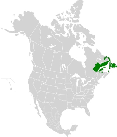
The Eastern Canadian Boreal Forests ecoregion covers much of eastern Quebec, the southern part of Labrador, and the entire island of Newfoundland.
It is dominated by balsam fir and black spruce with an increasing dominance of balsam fir to the east, and white spruce dominates coastal areas.
The ecoregion has many unique non-forest communities, such as the serpentine and limestone barrens of Newfoundland and southern Labrador.
Landmarks & Parks: Saguenay River, Limestone barrens, Mont Valin.
Emblematic Animals: Eiders, Moose, Bear, Lynx, Fox, Snowshoe Hare, Grey Wolf.
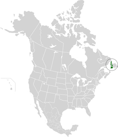
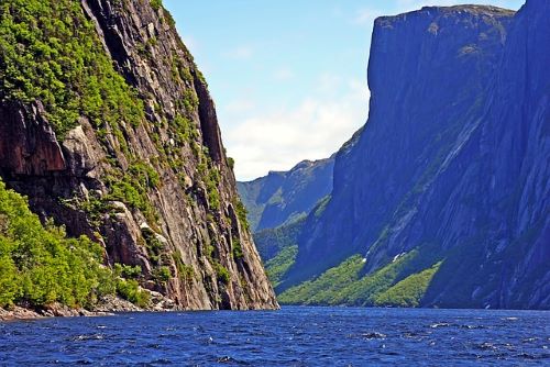
Newfoundland Highland Forests
The Newfoundland Highland forests ecoregion is located on the island of Newfoundland in Canada and covers a total area of 4,031,999 acres.
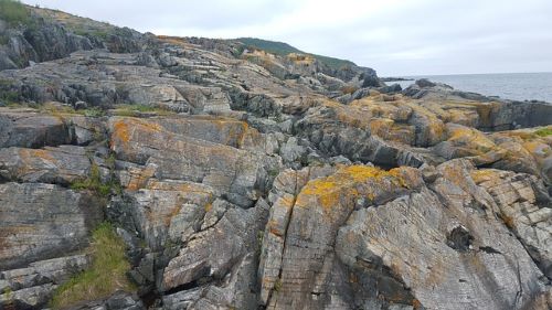
The region is characterized by rugged and steep terrain, primarily consisting of Palaeozoic and Precambrian rock formations.
Landmarks & Parks:
Emblematic Animals: Woodland Caribou, Newfoundland Pine Martens, Whales, Harbor Seals.
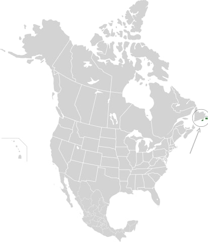
South Avalon-Burin Oceanic Barrens
Nestled within the rugged landscapes of Newfoundland and Labrador lies the South Avalon-Burin oceanic barrens, an ecoregion as stunning as it is unique.
This area is characterized by lush carpets of moss and fruticose lichen, alongside low-growing ericaceous shrubs and wildflowers.
Cape St. Mary’s hosts one of the world’s largest colonies of Northern gannets. If you’re looking for a truly remarkable wilderness experience, the South Avalon-Burin oceanic barrens are not to be missed.
Landmarks & Parks:
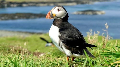
Emblematic Animals: Atlantic puffin, Northern Gannets, Willow Ptarmigan, Caribou.
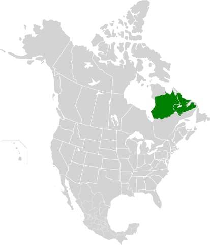
Eastern Canadian Shield Taiga
The Eastern Canadian Shield Taiga ecoregion is a vast area that extends from Hudson and James Bays to the Labrador Sea.
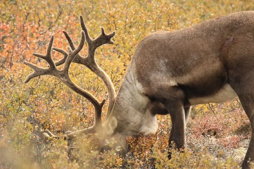
The western two-thirds of the ecoregion is in Quebec, while the eastern third is in Newfoundland and Labrador. The ecoregion is home to the George River barren-ground caribou and has a low level of protection.
The dominant vegetation is open, stunted woodlands of black spruce and tamarack, while the coastline is dominated by low white spruce forest and coastal heath.
Landmarks & Parks:
Emblematic Animals: Harbour Seals, Caribou (the George River herd of up to 400,000), Arctic Fox, Harlequin Duck.
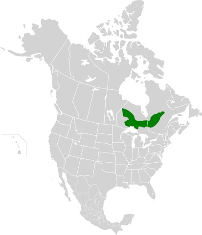
Central Canadian Shield Forests
The Central Canadian Shield Forests ecoregion is characterized by the Canadian Shield geology, glaciations, and rising land surface. This boreal ecoregion is dominated by black spruce in the north, with fire-adapted jack pine, quaking aspen, and paper birch.
The ecoregion is threatened by logging, mining, mineral exploration, and hydroelectric development, and priority conservation actions are needed to protect the remaining natural habitats.
Landmarks & Parks:
- Wabakimi Provincial Park
- Pukaskwa National Park
- La Verendrye Wildlife Reserve
- Aiguebelle National Park
- Kesagami Provincial Park
Emblematic Animals: Canada Goose, Pileated Woodpecker, Great-horned Owl, Lake Sturgeon.
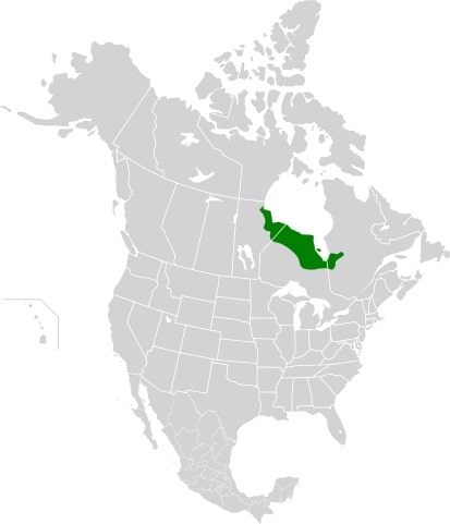
Southern Hudson Bay Taiga
The Southern Hudson Bay Taiga ecoregion is a large expanse of wilderness in North America, with 83% in Ontario and the rest in Quebec and Manitoba.
The Hudson Bay Lowland is the most extensive wetland complex in North America, and the third largest on Earth, with a vast, mostly flat landscape of limestone bedrock.
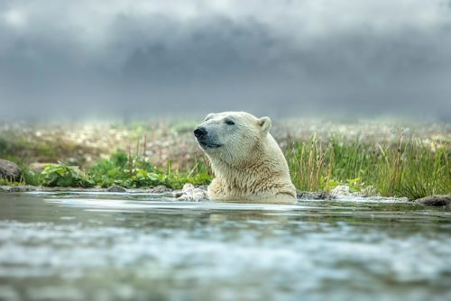
The ecoregion is home to the southernmost population of polar bears in North America, both woodland and barren-ground caribou. It is also a stronghold for boreal birds, shorebirds, and waterfowl.
Landmarks & Parks:
Emblematic Animals: Polar Bear, Caribou, Beluga Whales, Boreal Birds, Shorebirds, Waterfowls, Snow Goose, Brant, and Canada Goose.
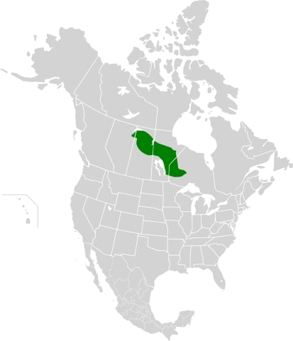
Midwestern Canadian Shield Taiga
The Midwest Canadian Shield Forests ecoregion is a large area stretching through Ontario, Manitoba, Saskatchewan, and Alberta, defined by the Canadian Shield and glacial sediments.
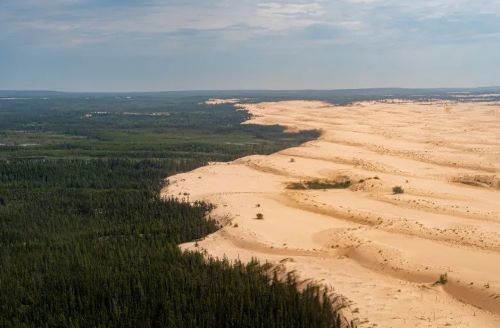
It has a sub-humid mid- to high-boreal climate, dominated by black spruce and jack pine, with occasional lightning fires. The Athabasca Sand Dunes within this ecoregion is home to 10 endemic plant species.
Threats to the ecoregion include logging, mineral exploration, mining, acid deposition, and hydroelectric development.
Landmarks & Parks:
- Athabasca Sand Dunes Provincial Park
- Opasquia Provincial Park
- Woodland Caribou Provincial Park
- Atikaki Provincial Park
- Lac La Ronge Provincial Park
Emblematic Animals: Moose, Woodland Caribou, Canadian Lynx, Wolf, and Beaver.
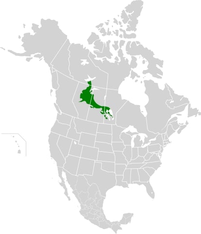
Mid-Continental Canadian Forests
Traveling through the Mid-Continental Canadian Forests from the Great Slave Lake to Manitoba is an adventure filled with diverse flora and fauna.
The area features a mix of lowlands and mountains up to 800m high, with areas of wetlands, peat bogs, and mountain lakes and ponds.
You’ll spot conifers and deciduous trees like quaking aspen, white spruce, and black spruce.
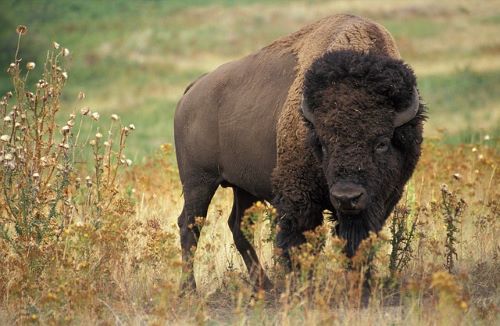
The region also boasts Wood Buffalo National Park, which is home to the world’s largest herd of American bison, and the wetlands, such as Cumberland Lake, provide vital habitat for migratory birds, including the endangered whooping crane.
Landmarks & Parks:
- Wood Buffalo National Park
- Prince Albert National Park
- Riding Mountain National Park
- Duck Mountain Provincial Park
- Meadow Lake Provincial Park
- Narrow Hills Provincial Park
Emblematic Animals: White-tailed Deer, Bison, Elk, Coyote, American White Pelican, Sandhill Crane.
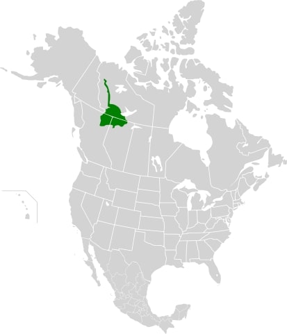
Muskwa-Slave Lake Forests
This boreal ecoregion in question encompasses various areas, including the forest between Mackenzie and Franklin Mountains, the Liard River basin, and the Caribou Mountains in north-central Alberta.
The landscape is characterized by low mountains, plateaus, and wide plains broken by bogs and wetlands, such as Zama Lake.
The subarctic climate sees summer temperatures averaging around 12.5°C and winter temperatures averaging from −18°C to −24.5°C.
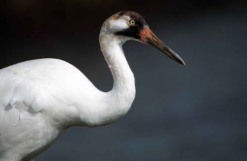
Muskwa-Slave Lake ecoregion contains the largest and only natural breeding population of the endangered whooping crane.
The vegetation is dominated by dense forests of trembling aspen, white spruce, and balsam fir.
There’s a beaver dam in Wood Buffalo National Park measured to be 850m long, that’s the world’s largest known beaver dam!
Landmarks & Parks:
Emblematic Animals: Woodland Caribou, Wood Bison, Mule Deer, Grizzly Bear, Canada Lynx, Whooping Crane.
Northern Canadian Shield Taiga
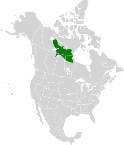
The Northern Canadian Shield Taiga ecoregion is a vast area stretching across Northwest Territories, Alberta, Saskatchewan, Nunavut, and Manitoba. It contains nearly one-quarter of the tree line in North America, marking the transition from taiga to tundra.
The climate is subarctic with short, cool summers and very cold winters. The geology is characterized by the Canadian Shield, which is some of the oldest rocks on the continent.
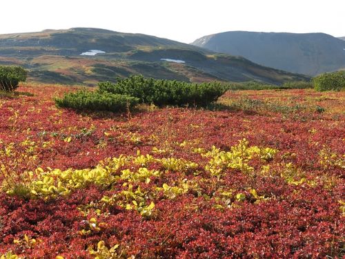
The vegetation is dominated by sparse and stunted black spruce and a ground layer of dwarf birch, shrubs, mosses, and lichens.
Landmarks & Parks:
- Thelon Wildlife Sanctuary
- Baralzon Lake Ecological Reserve
- Caribou River Provincial Park
- Numaykoos Lake Provincial Park
- Fidler-Greywillow Wildland Park
- Sand Lakes Provincial Park
Emblematic Animals: Bathurst Barren-Ground Caribou, Willow Ptarmigan, Rock Ptarmigan, Sandhill Crane, Osprey, Raven, Spruce Grouse, and many Waterfowl.
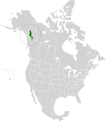
Northern Cordillera Forests
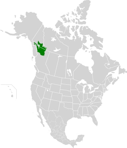
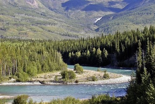
The mountains, valleys, and plateaus of this ecoregion serve as a transition zone between the Northern Rocky Mountains and the Coast and Saint Elias Mountains.
With a subarctic climate, this region experiences cool summers and frigid winters, with mean annual precipitation ranging from 350-600 mm, increasing to 1000 mm at higher elevations.
Vegetation zoning follows the elevation gradient, with lower elevations featuring boreal forests dominated by spruce and pine, while higher elevations are characterized by dwarf birch, willow, and ericaceous shrubs.
Landmarks & Parks:
- Denetiah Provincial Park
- Kusawa Territorial Park
- Nahanni National Park Reserve
- Neʼāhʼ Conservancy
- Spatsizi Plateau Wilderness Provincial Park
- Tā Chʼilā Provincial Park
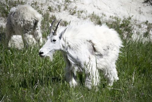
Emblematic Animals: Mountain Goat, Dall sheep, Hoary Marmot, Arctic Ground Squirrel, Snowy owl, Grizzly Bear, Glacier Bear, Salmon.
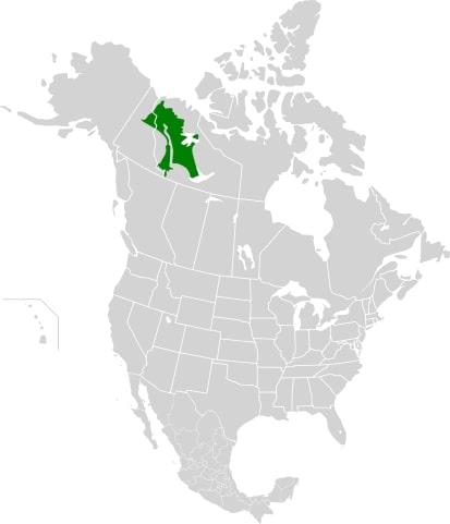
Northwest Territories Taiga
Welcome to the Northwest Territories taiga ecoregion, a vast area that stretches 1,200 km from the Great Slave Lake in the south to the Arctic Ocean in the north.
The ecoregion covers the forest and tundra surrounding the Mackenzie River Valley, which is one of broad lowlands, plateaus, and highlands in the southwest. With a predominantly subarctic climate, this ecoregion boasts mild summers and cold, snowy winters.
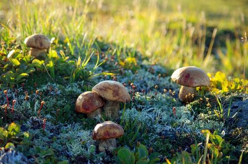
You can expect to find characteristic trees like black spruce, dwarf birch, Labrador tea, and willow, and a plethora of interesting edible mushrooms.
Landmarks & Parks:
- Nahanni National Park Reserve
- Edéhzhíe Protected Area
- Ts’udé Nilįné Tuyeta Territorial Protected Area
Emblematic Animals: Arctic Ground Squirrels, Marten, Moose, Woodland Caribou, Lynx, Black Bear.
Yukon Interior Dry Forests
Welcome to the southern Yukon, where the rugged Yukon Plateau is home to an incredible diversity of flora and fauna. This ecoregion boasts a dry subarctic climate, where the summers are mild and the winters are cold and snowy.
The rolling hills, plateaus, and broad valleys support an array of vegetation, black spruce, white spruce, and lodgepole pine are among the most common trees in this region, while grassland communities dominate the south-facing, low-elevation slopes
Although well preserved, this region faces threats from timber harvesting, mining, and a state-sponsored wolf kill.
Landmarks & Parks:
Emblematic Animals: Caribou, Mountain Goat, Dall Sheep, Moose, Grizzly Bear, Gray Wolf, Golden Eagle.
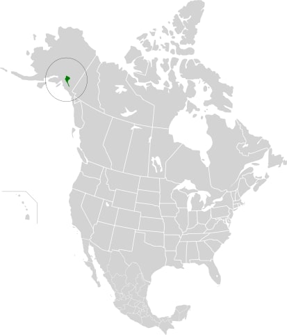
Copper Plateau Taiga
The Copper Plateau taiga is a remarkable ecoregion of North America, characterized by a flat plateau in southeastern Alaska surrounded by high mountains, lakes, and marshes.
This damp region with up to 460mm of rainfall per year sees a wide range of temperatures from -27 °C in winter to 21 °C in summer. Black spruce dominates the region, while wetter areas have dwarf birches, shrubs, sedges, and herbs.
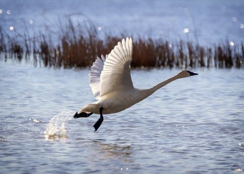
Birds such as trumpeter swans and salmon, especially Chinook and sockeye salmon, thrive in the area, while the Nelchina caribou herd migrates across the western side of the plain.
The ecoregion is almost entirely within the Wrangell – St. Elias National Park and Preserve and is a unique and diverse ecosystem worth preserving.
Landmarks & Parks: Wrangell–St. Elias National Park and Preserve
Emblematic Animals: Trumpeter Swans, Chinook Salmon, Sockeye Salmon, Nelchina Caribou, Bald Eagles.
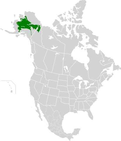
Interior Alaska Yukon Lowland Taiga
The Interior Alaska-Yukon lowland taiga is a vast ecoregion characterized by spruce taiga forest covering the central and northern parts of Alaska and Yukon.
The area is mainly made up of low hills and flatlands with permafrost soil, and it has a continental climate with short summers and long, cold winters.
The ecoregion is home to a variety of flora, including white spruce, black spruce, dwarf birch, willows, alders, balsam poplars, and quaking aspen, among others.
The Bonnet Plume River and Wind Rivers that flow into the Peel River are also popular destinations for rafting and kayaking.
Landmarks & Parks: Nogohabara Sand Dunes
- Yukon Flats National Wildlife Refuge
- Kanuti National Wildlife Refuge
- Koyukuk National Wildlife Refuge
- Innoko National Wildlife Refuge
- Nowitna National Wildlife Refuge
- Arctic National Wildlife Refuge
- Vuntut National Park
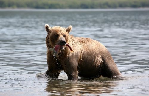
Emblematic Animals: Porcupine Caribou, Grizzly Bear, Gray Wolf, Rock Ptarmigan, Great White Owl, Chinook Salmon.
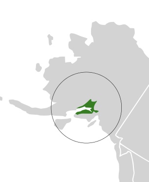
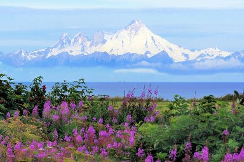
Cook Inlet Taiga
The ecoregion around the upper Cook Inlet in Alaska has a varied plant life that includes conifers, other trees, shrubs, and herbs.
The dominant trees in this region are black spruce, white spruce, Sitka spruce, quaking aspen, balsam poplar, black cottonwood, and paper birch. The spruce forest is regularly renewed following severe damage by spruce bark beetle infestations.
Landmarks & Parks:
Emblematic Animals: Pacific Salmon, Bald Eagles, Snow Geese, Grizzly Bear, Black Bear, Beluga Whales, Humpback Whales.
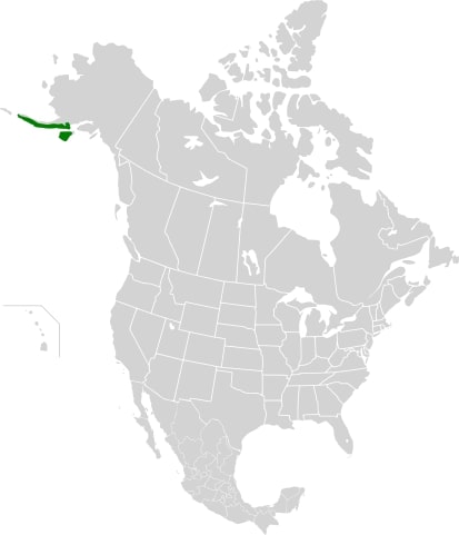
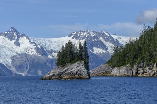
Alaska Peninsula Montane Taiga
The Alaska Peninsula montane taiga is an ecoregion characterized by mountainous terrain, a freezing climate, and a variety of flora and fauna. The mountainsides are covered with scrubby vegetation, while the lower slopes have evergreen trees such as balsam poplars.
The region is home to large populations of bears, including the Kodiak bear subspecies of brown bears.
Despite the threat of hunting and fishing, the natural habitat is in pristine condition and protected in areas such as Katmai National Park and the Alaska Peninsula National Wildlife Refuge.
Landmarks & Parks: McNeil River
- Katmai National Park
- Alaska Peninsula National Wildlife Refuge
- Izembek National Wildlife Refuge
- Kodiak National Wildlife Refuge
- Aniakchak National Monument and Preserve
- Becharof National Wildlife Refuge
Emblematic Animals: Kodiak Bear, Moose, Alaskan Hare, Snow Geese, Tufted Puffin, Murres, Northern Fulmars, Killer Whales, Sea Lions.
Boreal Ecoregions: Conclusion
That’s it! This covers the wonders of the boreal ecoregions of North America.
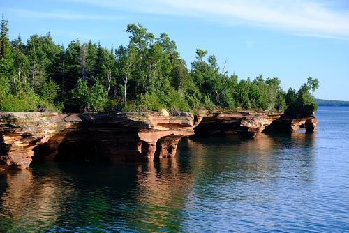
From the stunning Athabasca Sand dunes to the chiseled shores of lake superior, and the mysterious glacier bears of the Northern Cordillera Forests, there are many hidden gems in the Northern Forests!
Now, do you wonder what gems are hidden in the Eurasian boreal ecoregions? Follow up with the next article!
